


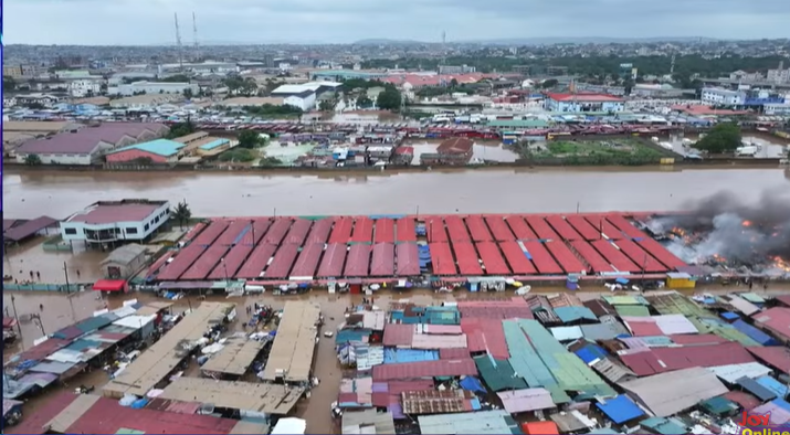
Urban Development Planner Kofi Kekeli Amedzro has attributed the growing incidence of illegal developments in protected and flood-prone areas to weaknesses in local land use planning, warning that critical implementation gaps are undermining Ghana’s spatial planning framework.

Speaking on Joy News’ PM Express on Tuesday, Mr. Amedzro said that although national land use policies and planning laws exist, enforcement often breaks down at the local level because many assemblies lack detailed planning schemes needed to regulate development.
His comments come in the wake of the devastating floods that struck Accra, parts of the Central Region and other areas on Monday, claiming at least 18 lives and causing property damage worth millions of cedis.
“Ideally, before anyone should build, as the Land Use and Spatial Planning Act says, any form of development before it comes up, that development must conform with the land use plan of the area,” he said.
Mr. Amedzro stressed that land ownership alone does not give individuals the right to develop a property if the intended use conflicts with approved zoning regulations.
“Ownership alone does not determine the land use. Once an area has been designated or planned for a particular purpose, the district assembly’s Spatial Planning Committee—which includes planners, engineers, the Environmental Protection Authority, geologists and other professionals—determines whether to grant a development permit based on the approved land use plan for that area,” he explained.
He noted, however, that the planning system becomes ineffective when local-level plans are absent or incomplete.
According to him, although some areas are identified at the regional level as green belts, buffer zones or protected lands, many local assemblies have failed to prepare the detailed plans required to preserve those designations.
“You go there, and you request the local plan, specifically for those areas, and they are absent. So, in the absence of these things, sometimes the landowners, through their politics and what have you, get their way, and they do what they want to do,” he said.
Mr. Amedzro argued that these planning gaps create opportunities for land encroachment and unauthorised developments, often driven by political influence and vested interests.
He added that local authorities frequently struggle to enforce planning regulations, particularly when influential individuals are involved.
“It’s very difficult for the district assembly sometimes to enforce this, as you’ve rightly pointed out, and as you are aware of,” he noted.
The urban planner further warned that many of the areas affected by flooding are inherently unsuitable for construction because of their topography, yet development continues unchecked.
“When you go to these areas, even when you do analysis, the gradient from a planning perspective is far beyond the normal expectations. Yet you go there, and they are building,” he said.
Mr. Amedzro concluded that Ghana’s land use challenges are not solely technical but also political, arguing that these factors continue to frustrate the effective implementation and enforcement of spatial planning regulations.


